news
On November 1-2, KazAeroSpace took part in the international exhibition Expo 2020 in Dubai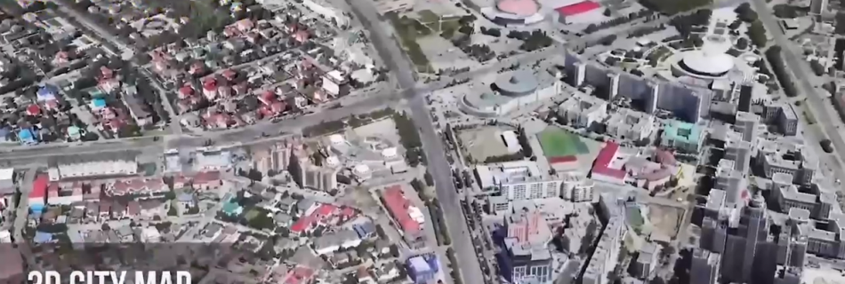
Within the framework of this event, the products of the company “Geoinformation Center of Nur-Sultan" were presented. Following the results of two days of presentations, excellent ratings were received from the expert society, potential partners and international clients. The uniqueness of this development is that in addition to 2d and 3d maps, a map of engineering networks has also been created.
Thanks to KazAeroSpace experts, today Nursultan is one of the leaders in the field of visualization of its urban territories.
The scientific and practical team of the company has all the knowledge, skills and experience in visualizing maps using the latest advanced programs and installations.
To date, KazAeroSpace is on par with major international companies in terms of quality and deadlines for projects.
Our main goal is to contribute to the prosperity of the city, improving the lives of the population and the development of the welfare of the country as a whole.
Subscribe